
New Orleans Neighborhood by Neighborhood: A Local Geography Primer
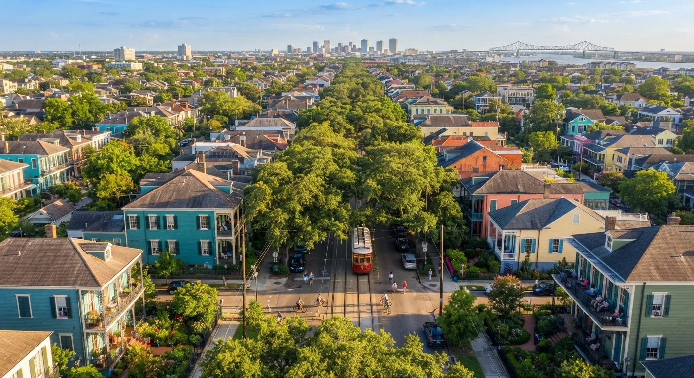
Photo credit: FaqsInsights.com | Stay Informed, Stay Ahead
In this article
The French Quarter is just the beginning. Understand how New Orleans' distinct neighborhoods differ in character, history, and atmosphere.
Why New Orleans Defies a Single Map
Most visitors arrive with one destination circled: the French Quarter. And while those narrow streets and wrought-iron balconies absolutely deliver, they represent only a sliver of what New Orleans actually is. The city is a mosaic of neighborhoods - each shaped by its own wave of immigration, architectural tradition, economic history, and cultural identity. Understanding the geography helps you move through the city with genuine curiosity rather than tourist tunnel vision.
New Orleans sits on a crescent of land between Lake Pontchartrain and the Mississippi River, which bends dramatically around the urban core. That curve is why locals use "riverside" and "lakeside" as directional terms rather than north and south. Streets follow the river's arc, which can disorient even experienced navigators. Add in the fact that the city's elevation changes block by block - a critical factor in terms of flood history - and you have a place that rewards slow, curious exploration.
| City Founded | 1718 by French colonists |
| Number of Recognized Neighborhoods | 73 official neighborhoods (City of New Orleans planning districts) |
| Primary Navigation Terms | Riverside, Lakeside, Uptown, Downtown |
| Oldest Neighborhood | French Quarter (Vieux Carré), est. 1718 |
| Key Dividing Street | Canal Street - separates French Quarter from CBD/American Sector |
| Oldest African American Neighborhood | Tremé, widely considered oldest in the US |
The Core Neighborhoods, Defined
French Quarter (Vieux Carré): The oldest neighborhood in the city, established by French colonists in 1718. Its grid layout, Spanish Colonial architecture (most original French buildings burned in late 18th-century fires), and dense concentration of music venues make it the city's most visited district. It can feel performative for residents - most Quarter regulars are tourists - but the history embedded in every courtyard is genuine.
Marigny & Bywater: Just downriver from the Quarter, the Marigny is where local music culture thrives. The main artery, Frenchmen Street, hosts live jazz, brass band, and blues in small clubs with no cover. Bywater, edging further downriver, has become an arts district with a creative, bohemian character and colorful Creole cottages.
Garden District & Uptown: The Garden District is defined by grand antebellum mansions built by American merchants in the 19th century - a deliberate counter-culture to the Creole Quarter. Uptown extends further along the river, home to Tulane and Loyola universities, the Audubon Zoo, and Magazine Street's eclectic stretch of locally owned shops and restaurants.
Mid-City: A largely residential neighborhood anchored by City Park - one of the largest urban parks in the US - and the beloved New Orleans Museum of Art. Mid-City has a workaday authenticity and some of the city's most beloved neighborhood restaurants.
Tremé: Widely considered the oldest African American neighborhood in the country, Tremé is the cultural cradle of New Orleans jazz. Its community of musicians, second-line parade culture, and historic St. Augustine Church make it essential for understanding the city's deeper roots.
Vieux Carré
French for "Old Square," the formal name for the French Quarter. The term reflects the neighborhood's origins as a planned French colonial settlement in 1718.
Shotgun House
A long, narrow single-story home style common throughout New Orleans, where rooms are arranged in a straight line from front to back. The name derives from the idea that a shotgun blast could travel straight through without hitting a wall.
Creole Cottage
A vernacular architectural style native to New Orleans, typically a small, symmetrical single-story home built close to the street, often with a pitched roof and front-facing doors. Common in Marigny and Bywater.
Second Line
A New Orleans tradition originating in jazz funeral processions where the community follows a brass band through the streets. The "second line" is the group of community members dancing behind the main procession - a living tradition still active in neighborhoods like Tremé.
Lakeside / Riverside
The directional terms New Orleans residents use instead of north and south. Lakeside points toward Lake Pontchartrain; riverside points toward the Mississippi River.
CBD
Central Business District - New Orleans' commercial core, located just upriver from Canal Street. It blends modern office towers with historic warehouse architecture and is adjacent to the Warehouse Arts District.
Navigating Like a Local
New Orleans does not use cardinal directions the way most American cities do. Instead, locals orient by the river and the lake. Riverside means toward the Mississippi; lakeside means toward Lake Pontchartrain. Uptown refers to the direction upriver from Canal Street; Downtown means downriver. Canal Street itself is a crucial dividing line - it historically separated the Creole French Quarter from the American Sector.
Verify Current Conditions Before You Visit
Neighborhood character, access, and safety conditions can change over time, and some areas continue to navigate long-term recovery and development. Before visiting, check current travel guidance from official sources and connect with locally run visitor resources for the most accurate, up-to-date picture. Respect residents' spaces and communities as you explore beyond the tourist core.
Neighborhoods outside the tourist core - like Gentilly, Lakeview, Algiers (across the river on the West Bank), and the Lower Ninth Ward - each carry their own powerful histories, particularly related to Hurricane Katrina's impact and the city's ongoing recovery. These areas are not tourist attractions but living communities deserving of respectful, curious engagement.
The St. Charles Avenue streetcar line is one of the most practical ways to move between the CBD, Garden District, and Uptown, and it doubles as a moving window into the city's architectural variety. Wherever you wander, the city rewards those who step off the main routes.
73
Official neighborhoods in New Orleans
According to the City of New Orleans official neighborhood planning designations.
1,300+ acres
Size of City Park in Mid-City
City Park is among the largest urban parks in the United States, larger than New York's Central Park.
1718
Year New Orleans was founded
Founded by French colonist Jean-Baptiste Le Moyne de Bienville along the Mississippi River.

Author
Travel & Trips Editorial Team
Travel & Trips Editorial Team is the collective byline for our editorial team and contributor network. Articles published under this byline or an editorial pen name are researched, written, and reviewed according to our editorial standards for clarity, consistency, and independence before publication.
View all articles →